Beobachtungen:
Brunnen in Erfurt am Sonnenborn
Well in Erfurt
In Erfurt, östlich des Domplatzes gibt es ein Haus, das heute als Standesamt genutzt wird. Es trägt die Inschrift Sonnenborn.
Vor der Giebelfassade an der Strasse "Große Arche" steht ein schmiede-eisernes Gestell über einem ehemaligen Brunnen.
In der näheren Umgebung dieses Brunnenplatzes lassen sich zwei ausgedehnte Streifen spüren, der eine ist etwa einen Meter breit, der andere nur die Hälfte.
In
Erfurt, eastward of the "Domplatz" (cathedral) there is a house named
"Sonnenborn" used as register office. In front of the house there is as
construction of wrought iron. It marks the position of an old well. In
the near of this well two perceptable zones can be observed. One of
them has as width of about one meter, the other is about halv of it.
Interaktives Luftbild mit GoogleEarth areal photography
erfurt-apr-2010-sonnenborn.kmz
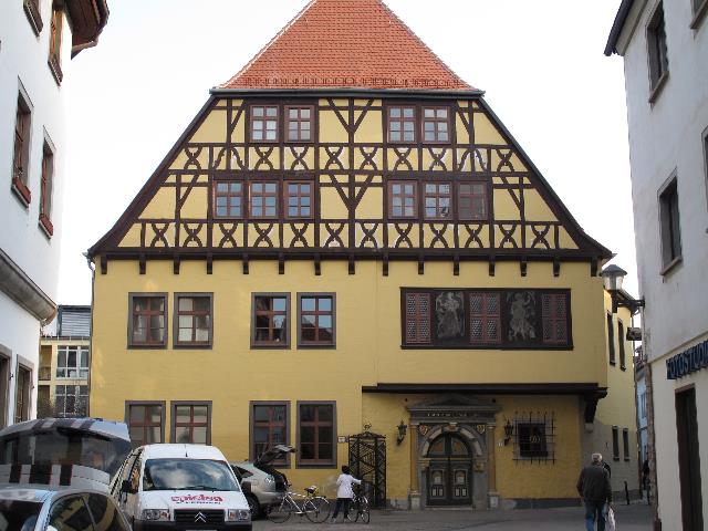 |
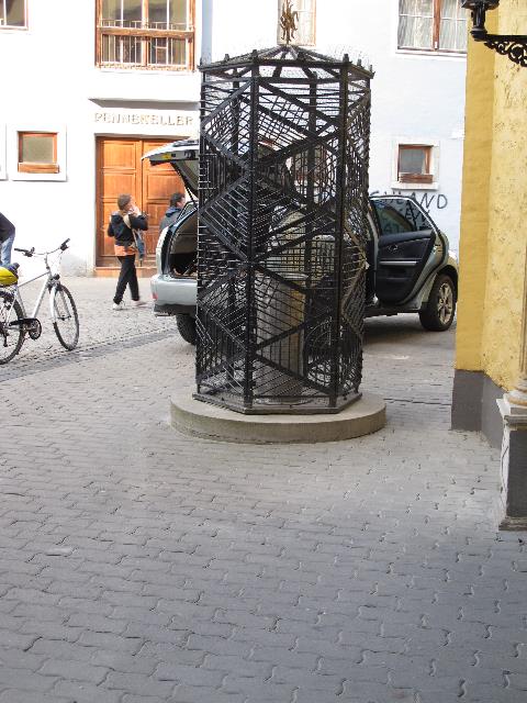
| Abb. 01:
Das Standesamt in Erfurt, Sonnenborn, in der Mitte davor steht ein
schmiedeeisernes Brunnengestell. The register office in Erfurt, Sonnenborn, with a wrought iron cage at the position of a former well. (FB) |
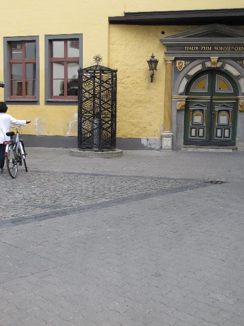 |
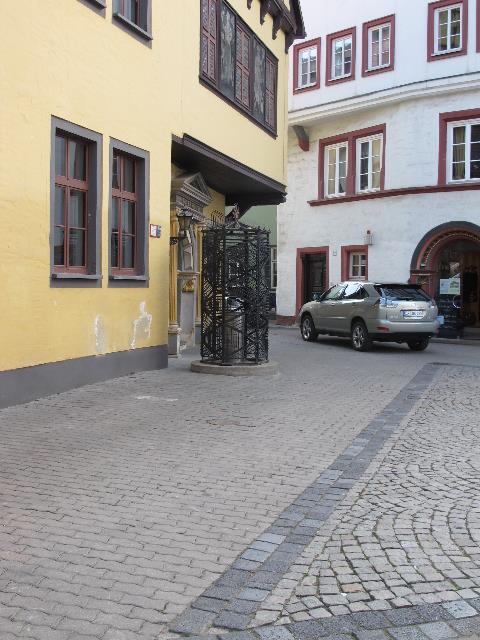
| Abb. 02:
Der Brunnen, etwa von der rechten unteren Bildecke bis zum Brunnen
verläuft ein rund einen Meter spürbarer Streifen. The well. Starting from the right lower picture corner a perceptable zone can be observed in direction toward the well. (FB) |
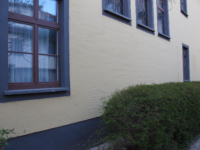 |
| Abb. 03: Ostseite des
Gebäudes. In Blickrichtung der Kamera verläuft ein etwa ein
Meter breiter spürbarer Streifen, der zum Brunnen führt.
Punkt 234 East side of the building. In the view direction of the camera a zone can be perceived about one meter wide. (FB) |
 |
| Abb. 04: In Blickrichtung
verläuft ein schmaler spürbarer Streifen. In the line of sight of the camera a smaller zone can be perceived. (FB) |
 |
| Abb. 05: umgekehrte Richtung,
auch hier ist der schmale Streifen zu spüren. The alignment of the small zone, but in the opposite direction. (FB) |
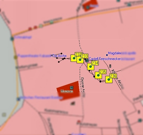 |
| Abb. 05: die Lage der markierten
Punkte im Stadtplan von Erfurt Position of the marked points. (FB) |
| Liste
der
markierten
Punkte,
Gesamt Dauer etwa zwei Minuten, Informationen zu den GPS-Daten: geologie-001 elapsed time about 2 minutes markierte Positionen der Spuren Name, Datum Uhrzeit, Koordinate Geländehöhe/ nicht kalibriert???? 232 10-APR-10 17:50:23 N50 58 37.7 E11 01 34.8 565 m 233 10-APR-10 17:50:30 N50 58 37.6 E11 01 35.3 562 m 234 10-APR-10 17:50:48 N50 58 37.2 E11 01 36.2 564 m 235 10-APR-10 17:51:13 N50 58 36.8 E11 01 36.8 565 m 236 10-APR-10 17:51:42 N50 58 36.5 E11 01 37.7 565 m |
| Tabelle: GPS-Koordinaten,
reduzierte Genauigkeit wegen der Abschattung durch die Gebäude. Reduced accuracy, the buildings screen the GPS-Signals partly. |
 |
www.biosensor-physik.de | (c)
12.04.2010 F.Balck |
© BioSensor-Physik 2008 · Impressum