
Beobachtungen:
Mühlbach
Der Mühlbach in Igensdorf fließt teilweise unterirdisch.
Die spürbaren Strukturen vom Betonkanal sind gut an der Oberfläche als zwei parallele Linien wahrzunehmen.
Sie erlauben es, den genauen Verlauf mit Schnüren auf der Oberfläche einer Straße auszulegen.
Der Abstand der beiden Linien entspricht etwa der inneren Breite des Kanals. 2.5 m
The Mühlbach in Igensdorf flows partly underground.
The perceptible structures of the concrete channel are well perceived on the surface as two parallel lines.
They allow the exact course to be laid out with strings on the surface of a road.
The distance between the two lines corresponds approximately to the inner width of the canal. 2.5 m
 |
| Abb.
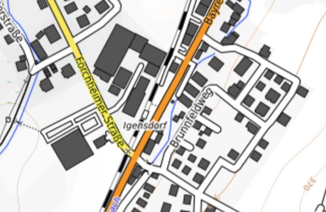
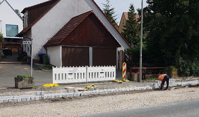
01: Der Mühlbach in 91338 Igensdorf fließt zwischen B2
(Bayreuther Straße) und Brunnfeldweg ein Stück unterirdisch. Darüber
sind die Zufahrten zu mehreren Garagen. The Mühlbach in 91338 Igensdorf flows underground for a stretch between B2 (Bayreuther Straße) and Brunnfeldweg. Above it are the access roads to several garages. https://opentopomap.org/#map=17/49.61991/11.23526 |
 |
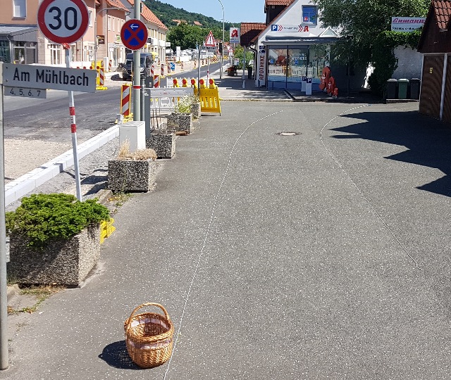
| Abb. 02: Am Mühlbach: Die spürbaren Ränder sind mit Kamilleblüten und weißer Schnur ausgelegt. Der Bach kommt von Norden und fließt östlich hinter der Apotheke vorbei. Deckel einer Einstiegsöffnung At the mill stream: The perceptible edges are lined with camomile flowers and white string. The stream comes from the north and flows east past the pharmacy. Cover of a manhole (FB) |
 |
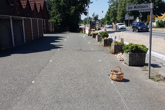
| Abb. 03: Apotheke im Hintergrund, die markierten Ränder zeigen sich als parallele Linien Pharmacy in the background, the marked edges show as parallel lines (FB) |
 |
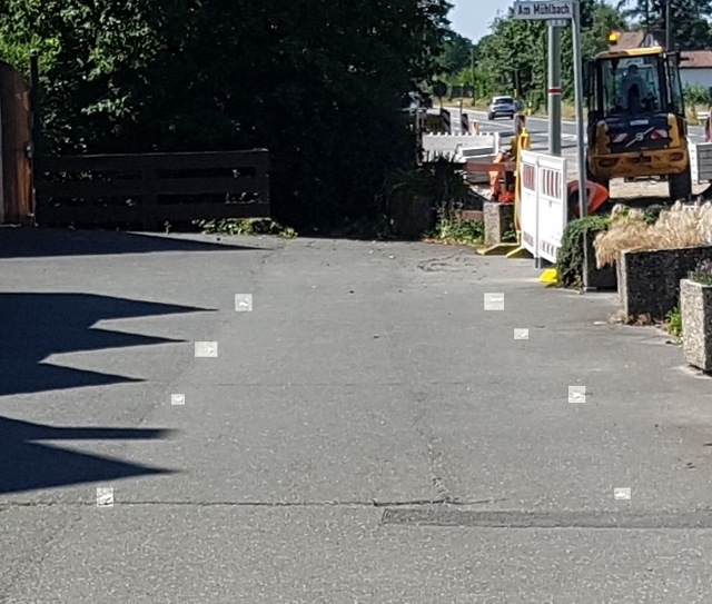
| Abb. 04: Die Hilfsmarkierungen mit Kamillenblüten sind auf dem Foto nachträglich aufgehellt. Die spürbare Struktur hat nahezu parallele Ränder. The auxiliary markings with camomile flowers have been subsequently lightened in the photo. The perceptible structure has almost parallel edges. (FB) |
 |
| Abb. 05: Blick nach Süden, bergab. Auch auf diesem Foto sind die ausgelegten Hilfsmarkierungen nachträglich aufgehellt. parallele Linien View to the south, downhill. In this photo, too, the laid-out auxiliary markings have been subsequently lightened. parallel lines (FB) |
 |
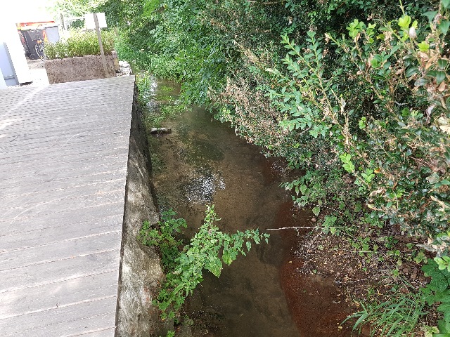
| Abb. 06: Am Ende des Parkstreifens kommt der Bach
wieder an die Oberfläche und fließt links von dem kleinen Wartehäuschen
weiter nach Süden. At the end of the park strip, the stream resurfaces and flows further south to the left of the small bus shelter. (FB) |
 |
| Abb. 07: hinter dem Laternenpfahl rechts kommt der Bach wieder heraus behind the lamppost on the right, the stream comes out again (FB) |
 |
| Abb. 08: Blick bergauf: vor dem Einlauf View uphill: before the inlet (FB) |
 |
| Abb. 08: An der Apotheke Blick bergauf: vor dem Einlauf At the pharmacy Looking uphill: before the inlet (FB) |
 |
| Abb. 09: Blick bergab: vor dem Einlauf View downhill: before the run-in (FB) |
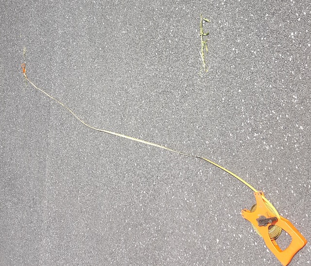 |
| Abb. 10: Ausmessen der Breite mit einem Maßband, Abstand zwischen den auslegten Markierungen (Kamillenblüten) = 2.7 m , an anderen Stellen 2.6 m bis 2.4 m Measure the width with a tape measure, Distance between the markings (camomile flowers) = 2.7 m, in other places 2.6 m to 2.4 m. (FB) |
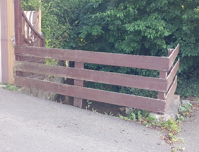 |
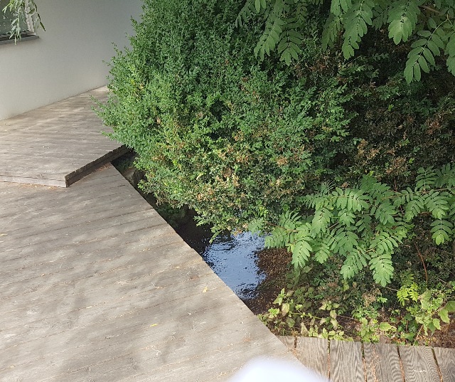
| Abb. 11: der Auslauf im Süden the outlet in the south (FB) |
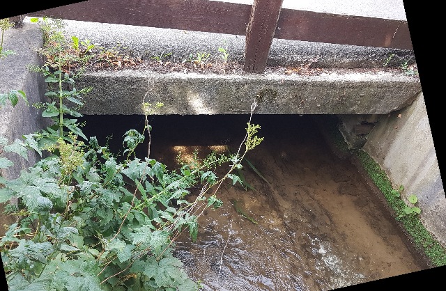 |
| Abb. 12: Blick von Süden in den Tunnel. Breite der Öffnung 2.5 m, Höhe vom Bachgrund bis unter die Betondecke: 1,0 m Überdeckung Beton und Asphalt ca. 0.4 m View from the south into the tunnel. Width of the opening 2.5 m, height from the bottom of the stream to below the concrete cover: 1.0 m. Covering concrete and asphalt approx. 0.4 m (FB) |
Literatur: b-literatur.htm
 |
www.biosensor-physik.de | (c) 18.07.2023 - 18.07.2023 F.Balck |
© BioSensor-Physik 2023
· Impressum