Beobachtungen:
Psi-Track-024, Verfolgen einer Spur, Orientierung,
Fortsetzung
Pursuing of a trace,
orientation, continuation
zum Verteiler Psi-Track und zu den anderen Psi-Track-Seiten psi-track-000
back
to
the
main
page
of psi track
1. Psi-Track Stockholm-Clausthal-Zellerfeld
2. Psi-Track und Hindernisse, Obstacles
2.2 Nebel , Fog
GPS-Daten
Instruktion, Umgang mit Luftbild Daten .KMZ für GoogleEarth: geologie-001.htm#gps-daten gosetal.htm#luftbilder
How to work with aerial photographs, GoogleEarth data .KMZ
1. Track Stockholm-Clausthal-Zellerfeld
Start in Stockholm 01.11.2016 15:55
GPS-Daten for googleEarth
2016-11-02-psi-track-stockholm.kmz
2016-11-03-psi-track-schweden.kmz
2016-11-04-psi-track-schweden.kmz
2016-11-05-psi-track-schweden.kmz
Am 1.11.2016 um 15:55 hat Mary Ryd von Stockholm aus einen Psi-track zu einem Objekt in Zellerfeld gelegt.
Sie ist Mitglied in einer Forschergruppe mit Göte Andersson. Göte hat als erster den Psi-Track gefunden und beschrieben.
Vortrag "Dowsing a sitrack" auf der 10th Biennial European Conference of the Society for Scientific Exploration, October 13 to 15, 2016
/Andersson 1994/ /Andersson 2009/ /Andersson 2016/
Dazu waren ihr zwei Fotos (Abb. 01 und Abb. 02) per Mail zugeschickt worden.
Etwa eine halbe Stunde später konnte ein Psi-Track mit den charakteristischen fünf inneren Strukturen am vereinbarten Ort
beobachtet werden.
Ungefähr zwei Stunden vorher war bei einem Kontrollgang um das Objekt herum kein entsprechender Track zu finden.
Der Track war am 4.11. noch zu spüren, allerdings war er etwas schwächer.
An diesem Tag wurden mit dem Auto einzelne Stellen angefahren, an denen eine Straße die Luftlinie kreuzt.
Zu Fuß wurde dann die Gegend nach Spuren von Psi-Tracks abgesucht. Bei einigen Plätzen war ein Track zu finden. Dort wurde jeweils ein Stück davon mit GPS Koordinaten protokolliert. Bei zwei Orten war die Richtung des Tracks etwa parallel zur Luftlinie.
(WPT 427 und WPT 437) Es gab Abweichungen von der Luftlinie bis zu 150 Meter.
Bei einem dritten Versuch stimmte die Richtung überhaupt nicht.(WPT 417)
Auch am 15.11. konnte der Track in der Nähe von Liebenburg noch gefunden werden.
Der Psi-Track
- braucht für die Einrichtung nur wenige Minuten,
- er folgt der Luftlinie,
- vermeidet Hindernisse und
- bleibt für einige Tage bestehen, allerdings mit abnehmender Intensität.
On 01.Nov.2016 at 15:55 M. R. layed a psi-track from Stockholm to a place in Germany in Zellerfeld.
She is in a group of researches around Göte Andersson. Göte is the "inventor" of Psi Tracks
Lecture "Dowsing a sitrack" at the 10th Biennial European Conference of the Society for Scientific Exploration, October 13 to 15, 2016
/Andersson 1994/ /Andersson 2009/ /Andersson 2016/
She had used two photos that were sent to her by mail before.
Half an hour later a track with the characteristic five elements could be found at the agreed place.
About two hours prior the place was "clear".
The track could be detected still on 4th of November. However, at that time it was very weak.
On that day the author drove by car to some places where a road crosses the direct line. There he walked by foot and searched for such tracts. If successful, he followed the track and recorded the GPS- coordinates of some points.
With two places the direction of the track was parallel to the direct line. (WPT 427 und WPT 437) The distance between the two objects was less than 150 m. A third trial was unsuccessfull. (WPT 417)
The track
- neads only minutes to be established.
- follows the direct line
- avoids obstacles
- stays for some days, with decreasing intensity.
10th Biennial European Conference of the Society for Scientific Exploration, October 13 to 15, 2016
"The Psi-track revisited -a pilot study
Andersson G, Ryd M
"Person/the Sender (S) and the Receiver/Object (0) seemed to be established. The track was primarily detected by Göte Andersson in collaboration with different experienced dowsers (D). .. . .
Methods
Long-distance experiments
S chooses a place to send from which is scanned and controlled for by 1) for irrelevant physical tracks of different kinds and 2) D for irrelevant tracks that the dowser might respond to. D leaves and S starts to send. S is sending when S has created an inner image of O and also experiences warm emotions towards 0. A good sender has the ability for strong focus and a longer period. The inner image is not "contaminated" by other thoughts, emotions or intentions. The sending lasts 2-5 min. The track is established after around 5 minutes with the character of a field from S to O with a width of about 1-2 meters. S leaves and D comes into the place where S has been sending with a dowser. D moves slowly around the sender spot in wider and wider circles. Every time the dowser responds, D puts a mark in the ground. Finally, there is a straight line connecting the marks. The line represents the middle of a psi-track. Along this track the object is to be found. The compass course is thus registered and matched with the true course defined with a map."
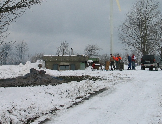 |
| Abb. 01: Foto-1 vom Objekt: Das Ziel. The target. 51°49'25.40"N 10°20'6.59"E (FB) |
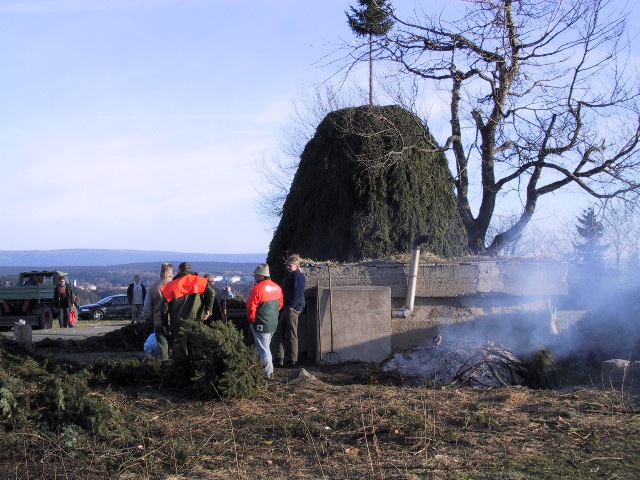 |
| Abb. 02: Foto-2 vom Objekt Osterfeuer. At Easter, the place is used for a large fire. links: Blick zum Brocken 1142 m, left: view to the Brocken (FB) |
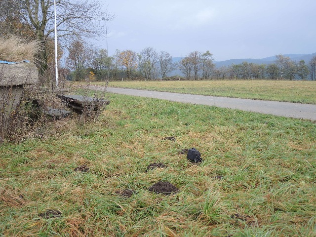 |
| Abb. 03: Wiese und Betonunterstand auf dem Berg, Blickrichtung nach Nord-Nord-Ost. Der Endpunkt des Tracks ist ungefähr in Bildmitte vorne im Gras bei der schwarzen Fototasche. View to north-north-east.The end of the track is marked with the black photo bag. (FB) |
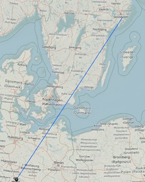 |
| Abb. 04: Strecke ca. 860 km. distance about 860 km. Die blue Linie ist die Luftlinie zwischen Startpunkt und Stockholm und Endpunkt in Zellerfeld. Blue line: direct line from starting point in Stockholm and ending point in Zellerfeld. http://www.openstreetmap.de/karte.html |
 |
| Abb. 05: gelb /yellow: 01.Nov..2016 16:30 Smartphone mit GPS-recorder, Abstand der Punkte jeweils 1 Minute. hellgrün /lightgreen: 02.Nov.2016 08:30 Garmin Etrex orange: 03.Nov.2016 10:00 Garmin Etrex blau/blue: Luftlinie Procedures 1.Nov.: yellow: 1. left lower corner: following the track (direction about north east) 2. return to the end of the track, about 90 meters to point WPT12 3. I walked along the way in order to get around the hedge. Then, parallel to the hedge I found a track. From WPT13 I walked down the hill up to the small road WPT14 (5 minutes for 400 meters in wet gras i.e. 4.8 km/h) However, when I looked at the map there is a break at the hedge: it was not your track, obviously something else. This is like the dog that should catch a duck and comes back with a bunny. http://www.openstreetmap.de/karte.html |
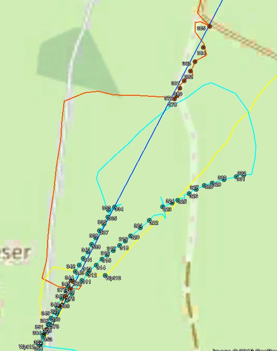 |
| Abb. 06: Nur die Anfänge der gelben Spur sind auf dem Track. Beim Umgehen der Hecke wurde die Spur verloren und eine andere verfolgt. Die hellgrüne Spur startet am Endpunkt des Tracks, geht bis zur Hecke. Und auch hier verliert der Spurensucher die Spur wieder. Er verfolgt eine andere. Danach läuft er in einem großen Bogen nach Nordwesten, steigt den Berg nach Südwesten wieder nach oben und schlägt einen Haken nach Südosten. Dann findet er die Spur wieder und erreicht auf gerader Linie den Endpunkt. Die orangene Spur verfolgt vom Endpunkt aus zunächst den Track bis zur Hecke. Danach geht es in einem großen Umweg zunächst nach Norden und dann nach Osten. Dort wird der Track gefunden und weiter nach Norden verfolgt. Yellow, light green and orange follow the track within the first section up to the hedge. Light green was successful at point 333 when coming back. Orange startet alike yellow or light green. After walking the small road for about 300 m the track could picked up again and pursued in northern direction - despite some obstacles like fences or ditches. http://www.openstreetmap.de/karte.html |
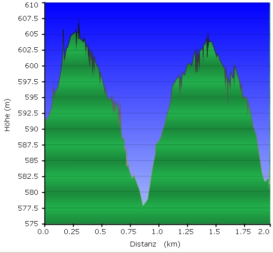 |
| Abb. 07: Höhenprofil für hellgrüne Spur. Heigth profile of the light green trace. |
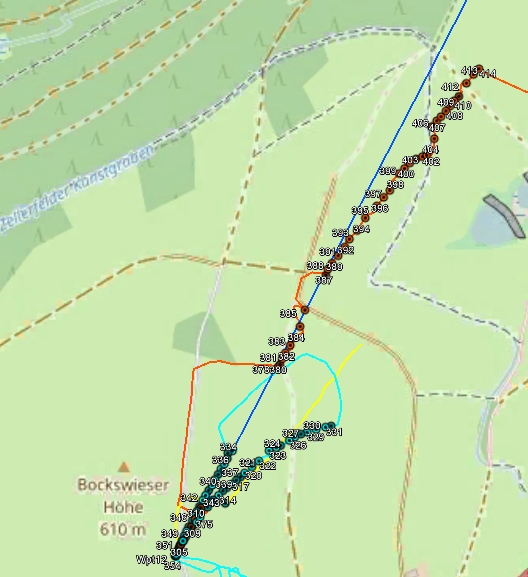 |
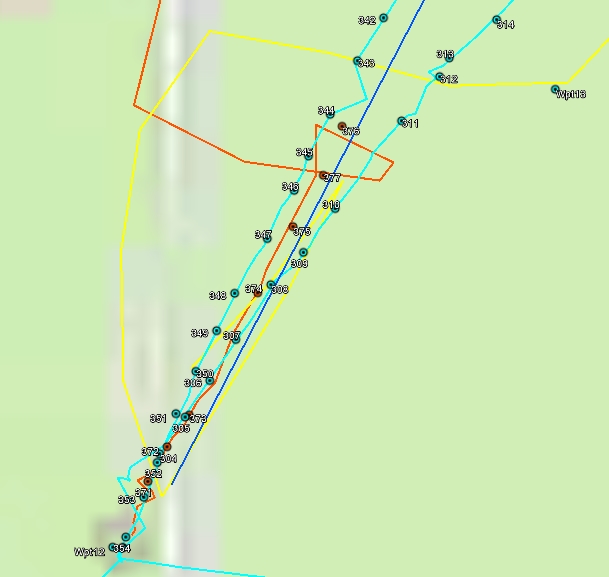
| Abb. 08: orange: Der Track wird verfolgt, dabei verläßt der Spurensucher mehrmals den Track, weil Hindernisse wie Zäune im Wege sind. Beim Rückkehren in einem weiten Bogen jedoch findet er den Track wieder. Bei den Wegepunkten 402 bis 404 verläuft der Zellerfelder Kunstgraben. Nach der Überwindung wird der Track wieder gefunden und noch über zweihundert Meter weiter verfolgt. Die Abweichung zur Luftlinie beträgt im nördlichen Bereich maximal 80 Meter. orange: following the track was interupted by fences WPT384- 385- 386 or a ditch WPT 401. http://www.openstreetmap.de/karte.html (FB) |
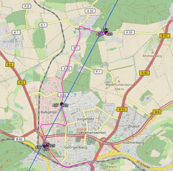 |
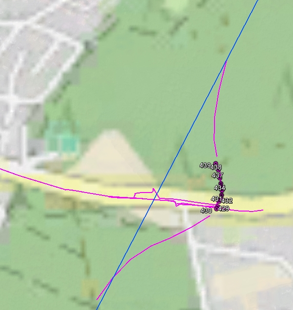
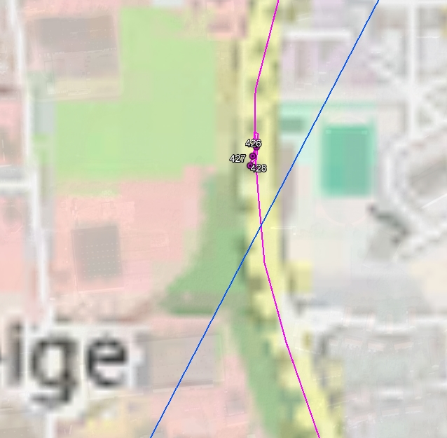
| Abb. 09: Fahrt mit dem Auto ungefähr 15 Kilometer weiter nach Nord-Nord-Ost entlang der Luftlinie. Bei 425 ergab sich eine Fehlsuche (Track von anderen Personen) Bei 417 und bei 438 könnte die gefundene Spur zum gesuchten Track gehören. Die Richtung ist zumindest parallel zur Luftlinie. Tour by car, in direction NNE along the direct line. Point 425, fault, track of other person. Points 417 and 438 could belong to the desired track. The found direction corresponds to the air line. 2016-11-04-psi-track-schweden.kmz http://www.openstreetmap.de/karte.html (FB) |
 |
| Abb. 10: Spurensuche in der Nähe der blauen Luftlinie nach Fahrt mit dem Auto bis in die Nähe davon. Beim Fußweg die Straße nach Westen und wieder zurück nach Osten konnte etwa 150 m weiter östlich ein Track gefunden werden, der die Straße bei 429 kreuzte. Dieser Track ließ sich nach Norden bis in den Wald hinein verfolgen. Bei der Kreuzung mit der Straße ist die gefundene Spur parallel zur Luftlinie. Hier scheint der Track einem Hindernis auszuweichen. Die gelben Linien sind auf dem Luftbild gemutet. No trace could be found at the assumed intersection point of the direct line with the track. However, about 180 m to the east there was a track. It could be traces through the forest. Here the track avoids some obstacles. Distance about 150 m from the blue line. yellow lines: found by remote viewing. 2016-11-04-psi-track-schweden.kmz http://www.openstreetmap.de/karte.html |
 |
| Abb. 11: Spurensuche in Goslar. Die Richtung der Spur verläuft parallel zur blauen Luftlinie. Der Abstand dazu beträgt rund 50 m. Parallel to the blue direct line it has distance of about 50 m. 2016-11-04-psi-track-schweden.kmz http://www.openstreetmap.de/karte.html |
15.11.2016
 |
| Abb. 11a: 15.11.2016, westlich von Liebenburg. 220 m östlich von der blauen Luftlinie und parallel dazu, parallel to the direct line (blue), distance 220 m 2016-11-05-psi-track-schweden.kmz http://www.openstreetmap.de/karte.html (FB) |
2
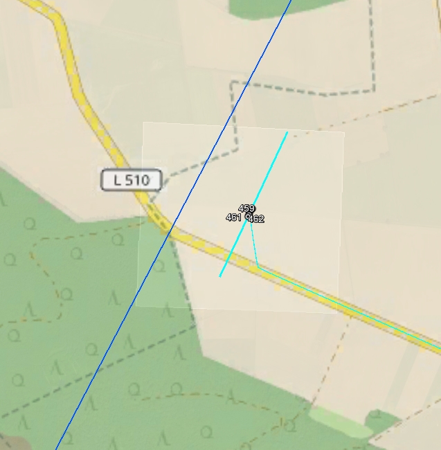
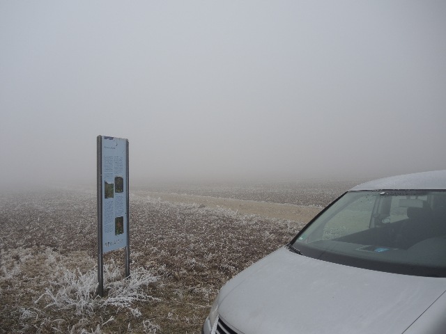
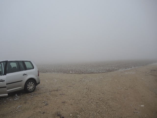
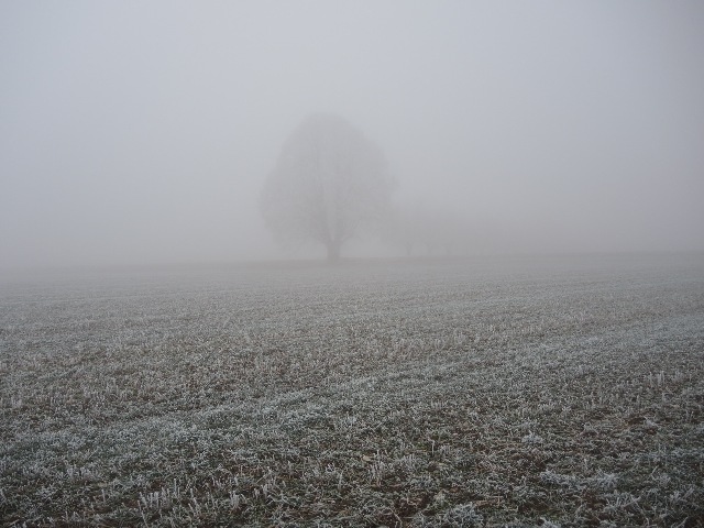
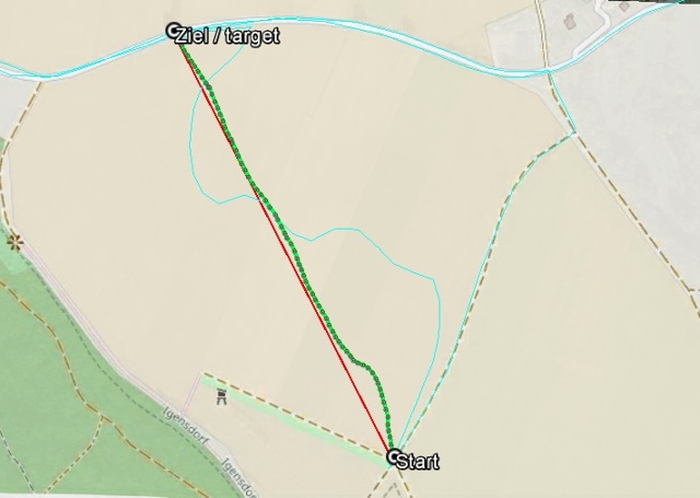
2.2 Psi-Track und Hindernisse 6.12.2016
Experiment mit nur einer Person: installieren und verfolgen eines Tracks.
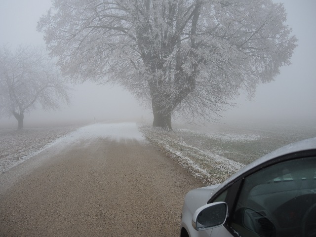
Es war nebliges Wetter mit Sichtweite von weniger als 50 m.
Das Ziel lag 610 m entfernt und war nicht sichtbar.
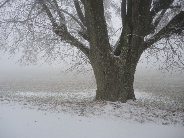
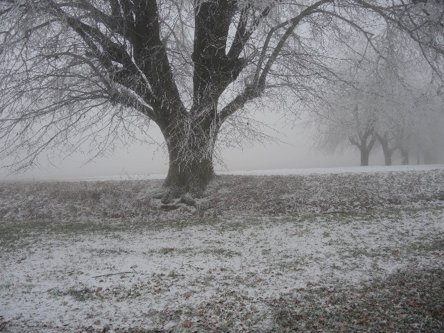
Als Ziel für den Track wurde ein kleiner Betonstein neben einer großen Linde ausgelegt.
Der Track wurde mental installiert und dann bis zum Ziel verfolgt.
Das Ziel konnte mit der Methode Psi-track innerhalb von rund 10 Minuten erfolgreich gefunden werden.
Die mittlere Geschwindigkeit betrug dabei 3,6 km/h
Only one person installs and pursues the track.
It was foggy weather with visibility 50 m.
The target was at a distance of 610 m and was not visible.
As a target for the track a small concrete block was placed next to a large lime tree.
The track was mentally installed and then pursued to the target.
With the method psi-track, the target could be successfully found within approx. 10 minutes.
Average velocity was about 3,6 km/h
11:12 Fahrt mit dem Auto zur Linde (Abb. 02-02-01) / by car to the lime tree
11:13 Auslegen des Steins an der Linde / stone at target position
11:13 bis 11:17 Fahrt mit dem Auto bis zum Startpunkt / by car to starting position
11:17 Auslegen des Psi-tracks / installing the track
11:20 Verfolgen der Spur ab Punkt 112 / pursuing the trace
11:30 Ankunft am Ziel bei Punkt 186 /arriving at the target position
---
11:32 am zweiten Startpunkt bei Punkt 187,
installieren des zweiten tracks. / at the second starting point, installing the second track
11:45 am zweiten Zielpunkt (Auto) bei Punkt 278 / arriving at the second target position (car)
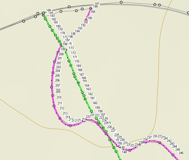
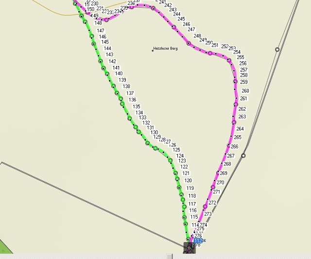
Daten für Luftbild 2016-12-06-igensdorf-pommer-psitrack-halb.kmz
Track 1
 |
| Abb. 02-02-01: Ziel /target Camera time: Creation Date (iptc): 2016-12-06T11:12 |
 |
| Abb. 02-02-02: Ziel /target Creation Date (iptc): 2016-12-06T11:13:08 |
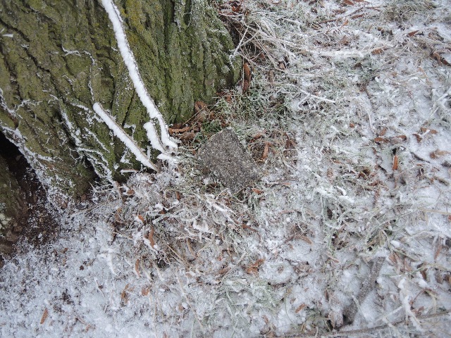 |
| Abb. 02-02-04: Ziel: der graue Betonstein, target: the gray brick (concrete) Unmittelbar nach erfolgter Suche aufgenommen, immediately photographed after successful search Creation Date (iptc): 2016-12-06T11:30:02 |
 |
| Abb. 02-02-05: Startposition Creation Date (iptc): 2016-12-06T11:17:12 |
 |
| Abb. 02-02-06: Startposition, ungefähre Richtung zum Ziel, presumed direction to the target Creation Date (iptc): 2016-12-06T11:17:21 |
 |
| Abb. 02-02-07: Weniger als zwei Minuten vor dem Ziel, der Baum wird sichtbar, Less than two minutes to the target, the tree becomes visible. Creation Date (iptc): 2016-12-06T11:28:11 |
 |
| Abb. 02-02-08: Nahe beim Ziel / near to the target Creation Date (iptc): 2016-12-06T11:29:43 |
 |
| Abb. 02-02-09: hellblau / light blue: automatischer GPS Track, track recorded automatically Strecke / distance 610 m START 112 06-DEZ-16 11:20:13 N49 38 51.8 E11 09 27.8 535 m END 186 06-DEZ-16 11:30:49 N49 39 09.4 E11 09 13.8 542 m (GPS time) Time for pursuing the track: 10:36 mittlere Geschwindigkeit mean velocity: 610 m/ 636 s ~ 1 m /s or 3,6 km/h openstreetmap.org. |
Track 1 daten-06-12-2016-track1
Track 2:
Der erste Track ist noch vorhanden. Es wird ein zweiter gelegt.
Das Ergebnis ist komplexer. Es bleiben viele Fragen.
Welche Gründe bzw. Hindernisse sind verantwortlich?
The first track still exists. Another track was installed.
The result is more complex. There are more questions left.
Which reasons or obstacles?
beide Tracks, Luftbild Daten 2016-12-06-igendsorf-pommer-psitrack.kmz
both tracks, areal photographs
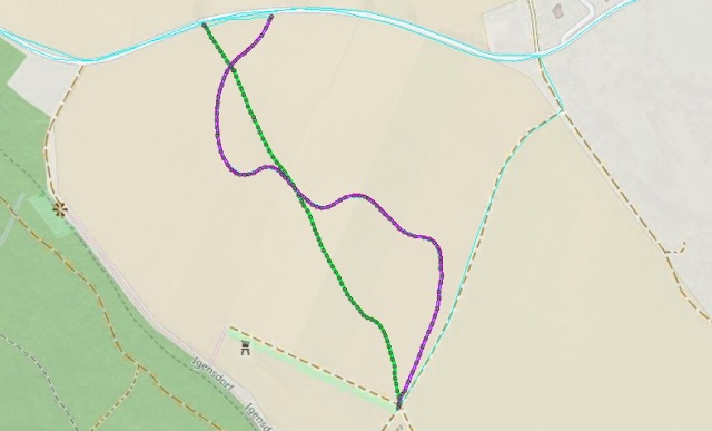 |
| Abb. 02-02-10: Grün /green: Track 01 Lila: Track 02, von einer neuen Startposition zurück zum Auto (unten) Es scheint eine Menge von Hindernissen zu geben. purple: track 02, from a new start position back to the car (below). There seem to be a lot of obstacles. Luftbild Daten 2016-12-06-igendsorf-pommer-psitrack.kmz |
 |
| Abb. 02-02-11: |
 |
| Abb. 02-02-12: |
Track 2: daten-06-12-2016-track2
Literatur: b-literatur.htm
 |
www.biosensor-physik.de | (c) 03.11.2016 - 31.05.2018 F.Balck |
© BioSensor-Physik 2018
· Impressum